Geospatial Intelligence Built on SAR, LiDAR & Satellite Imagery
Professional mapping consultancy serving industrial, infrastructure, and environmental clients across Indonesia — from data acquisition to validated deliverables.
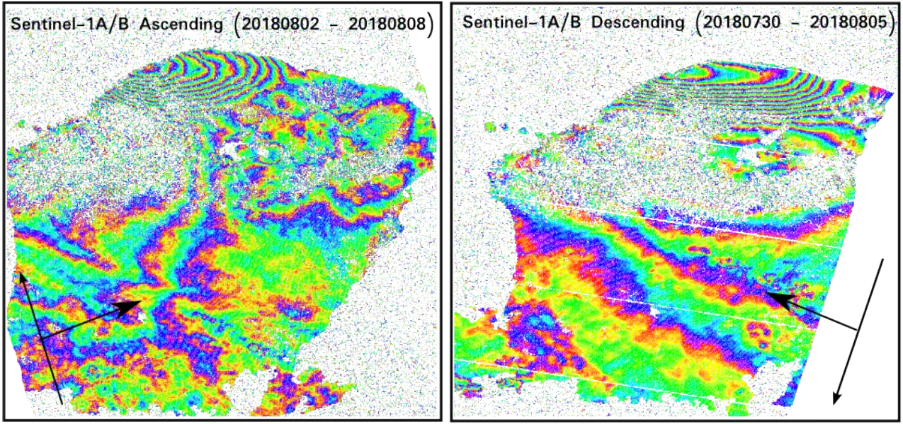
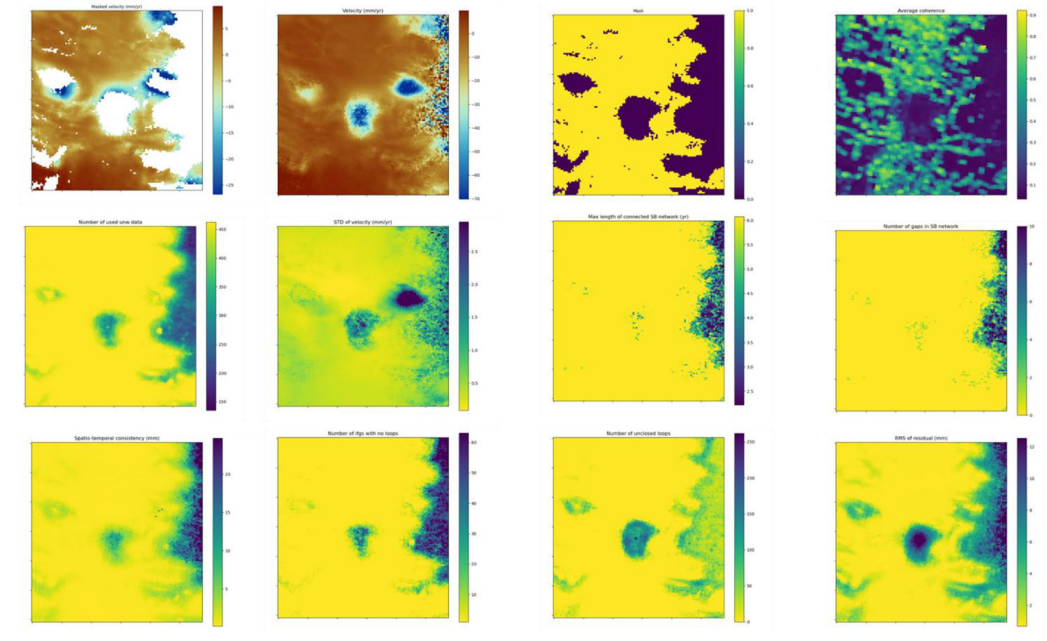
InSAR
Sub-centimeter surface deformation monitoring via satellite radar interferometry.
Target Scattering
Polarimetric analysis for land cover and object classification.
Optical Imagery
Multispectral and VHR satellite imagery analysis and classification.
LiDAR
Airborne and terrestrial point clouds, DSM and DTM production.
Why Geomix Technology
We combine certified expertise with institutional-grade remote sensing infrastructure to produce verifiable, decision-ready geospatial data.
Certified Expert Team
Our specialists hold international certifications in remote sensing, photogrammetry, and SAR data processing, backed by hands-on experience across national-scale projects.
State-of-the-Art Processing
We work with SARscape, Agisoft Metashape, and ENVI, paired with precision-calibrated field instruments to meet professional accuracy standards.
Validated Deliverables
Every analysis goes through rigorous QC and field validation so the data supports technical decisions, regulatory reporting, and long-term monitoring.
End-to-End Geospatial Solutions
From orbit to ground truth — acquisition, processing, and validation across radar, optical, and 3D mapping technologies.
Featured Projects
Mapping and monitoring work delivered across infrastructure, mining, agriculture, and heritage conservation.

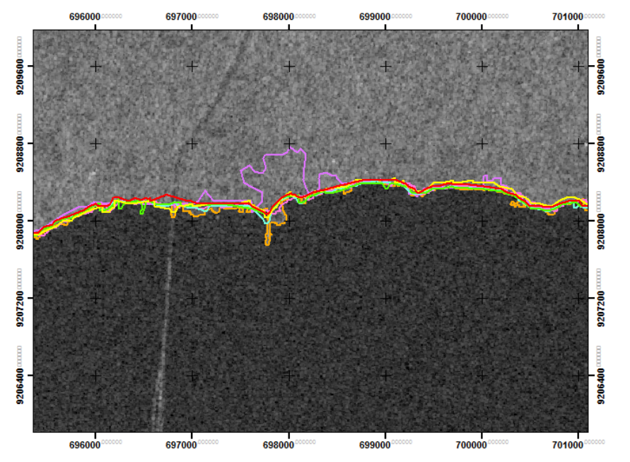
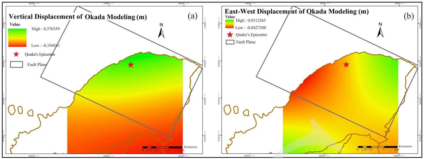
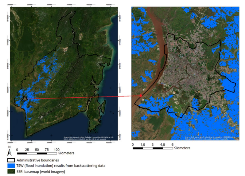
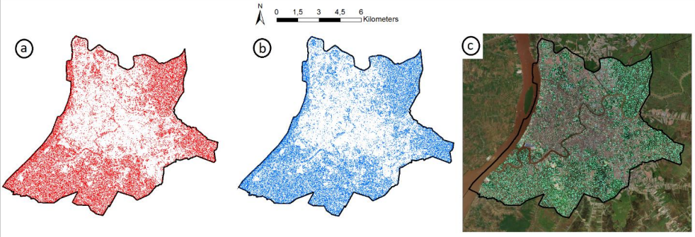
Coastal Land Subsidence Monitoring
Multi-temporal InSAR analysis tracking deformation along a vulnerable coastal corridor for flood-risk planning.

Open-Pit Slope Stability Mapping
LiDAR and SAR-based deformation monitoring across an active mining concession to flag early signs of instability.

Plantation Land Cover Assessment
Multispectral optical imagery analysis to classify plantation extent and monitor change across multiple seasons.

3D Documentation of Heritage Site
Photogrammetric and LiDAR reconstruction producing an accurate 3D model for conservation and research.
Corner Reflector Service
Custom-engineered corner reflectors for researchers, institutions, and industry professionals requiring precision and reliability for SAR/InSAR validation campaigns.
"Precision You Can Trust. Performance You Can Measure."